Accessibility 3
Below I plotted a three-dimensional, topographic plot that describes the de facto boundaries of urban areas, the center lines of classified roadways and the location of health care facilities by type throughout Ponhea Lueu and Mukh Kampul
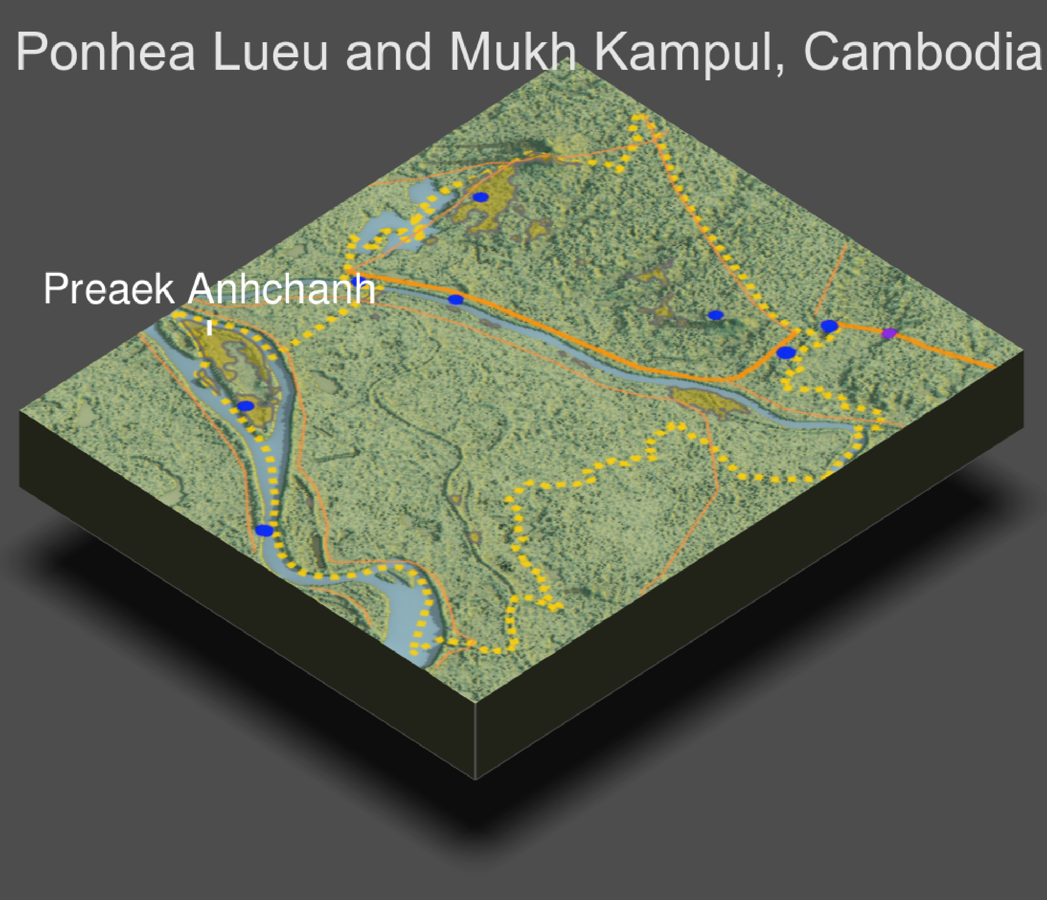
While the topography of my selected region seems to be relatively flat there are two or three mountaneous regions adjacent to urban areas where population density is high. Urban areas and healthcare facilities are still built on flat areas but roads/transportation facilities had to have been built through two of the mountain ranges to maintain close access to where population is high. Nothing from this 3d analysis has contradicted previous findings I made through past plots. If anything, these results just extend my past findings and provide another lense to view the combined adm 2’s. We can interpret from this 3d map that topography does influence cambodias infrastructure in Ponhea Lueu and Mukh Kampul, as urban areas and healthcare facilities are built at lower/flatter elevation regions (and half of hospitals are also by the water too).